
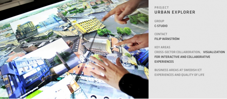
Urban Explorer Table 2 was developed by Interactive Institute Swedish ICT together with the city planning office of Norrköping in Sweden in close collaboration with Visualisation Centre C, Hyresbostäder in Norrköping and City Planning Office of Gothenburg.
"In the Urban Explorer project, we combine the world highest quality 3D maps with leading edge hardware, add data sources straight from research and create prototypes using natural interfaces. Then, we place it right in front of the actual stakeholders for testing out it's worth in real scenarios."
Read more at Urban Explorer

