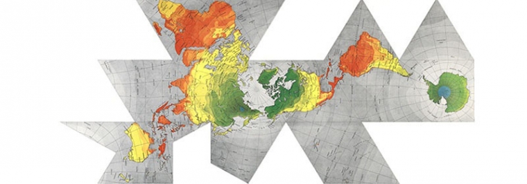
The great Buckminster Fuller created a series of Dymaxion maps utilizing various forms of his patented Fuller projection in the 1940s and 50s. The most well-known, icosahedral form of the projection was devised in Raleigh, North Carolina, in 1954. Fuller intended the projection to better balance shape and areal distortion, while also eschewing the north-south cultural bias he saw in common projections.
